
IMAGES TAKEN NEAR TO
The Meadows, MILLTIMBER, AB13 0JT
Introduction
This page details the photographs taken nearby to The Meadows, AB13 0JT by members of the Geograph project.
The Geograph project started in 2005 with the aim of publishing, organising and preserving representative images for every square kilometre of Great Britain, Ireland and the Isle of Man.

There are currently over 7.5m images from over14,400 individuals and you can help contribute to the project by visiting https://www.geograph.org.uk
Image Map
Images are licensed for reuse under creativecommons.org/licenses/by-sa/2.0
Notes
- Clicking on the map will re-center to the selected point.
- The higher the marker number, the further away the image location is from the centre of the postcode.
Image Listing (8 Images Found)
Images are licensed for reuse under creativecommons.org/licenses/by-sa/2.0
Image
Details
Distance
2

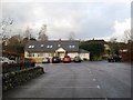
Deeside Christian Fellowship Church, Milltimber
Image: © Bill Harrison
Taken: 15 Oct 2025
0.11 miles
3

Milltimber Primary School
The school opened in 2022. School roll 2025: 330 (estimated).
Image: © Bill Harrison
Taken: 15 Oct 2025
0.16 miles
4
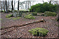
Binghill Recumbent Stone Circle (1)
This circle is in the deep shade of the woods near Binghill House. Seven stones remain of ten or so, but two are lurking, almost invisible, among the rhododendron bushes. The recumbent is still in position, but both flankers have fallen. See http://canmore.rcahms.gov.uk/en/site/19377/details/binghill/ for a fuller description. Image]
Image: © Anne Burgess
Taken: 28 Apr 2015
0.23 miles
5
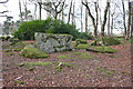
Binghill Recumbent Stone Circle (2)
Only three stones are still standing; the recumbent, in the middle of this view, is one. The other two are hidden among the rhododendrons; you can just about make out one at the left end of them. Some smaller kerb stones are still in position too. See http://canmore.rcahms.gov.uk/en/site/19377/details/binghill/ for a fuller description. Image]
Image: © Anne Burgess
Taken: 28 Apr 2015
0.23 miles
6
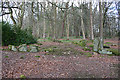
Binghill Recumbent Stone Circle (3)
The still standing recumbent (which sounds, but isn't, contradictory) is on the right, with the fallen west flanker in front of it. Most of the other visible stones are kerb stones. See http://canmore.rcahms.gov.uk/en/site/19377/details/binghill/ for a fuller description. Image]
Image: © Anne Burgess
Taken: 28 Apr 2015
0.23 miles
7
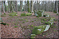
Binghill Recumbent Stone Circle (4)
In the foreground are some kerb stones still in their original position, curving round towards the recumbent and its fallen flankers. See http://canmore.rcahms.gov.uk/en/site/19377/details/binghill/ for a fuller description. Image]
Image: © Anne Burgess
Taken: 28 Apr 2015
0.23 miles
8
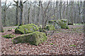
Binghill Recumbent Stone Circle (5)
Several large fallen stones in the east arc of the circle, with the recumbent still standing at the end of the arc. See http://canmore.rcahms.gov.uk/en/site/19377/details/binghill/ for a fuller description. Image]
Image: © Anne Burgess
Taken: 28 Apr 2015
0.23 miles