IMAGES TAKEN NEAR TO
Brimmond Court, ABERDEEN, AB11 8TX
Introduction
This page details the photographs taken nearby to Brimmond Court, AB11 8TX by members of the Geograph project.
The Geograph project started in 2005 with the aim of publishing, organising and preserving representative images for every square kilometre of Great Britain, Ireland and the Isle of Man.

There are currently over 7.5m images from over14,400 individuals and you can help contribute to the project by visiting https://www.geograph.org.uk
Image Map
Images are licensed for reuse under creativecommons.org/licenses/by-sa/2.0
Notes
- Clicking on the map will re-center to the selected point.
- The higher the marker number, the further away the image location is from the centre of the postcode.
Image Listing (13 Images Found)
Images are licensed for reuse under creativecommons.org/licenses/by-sa/2.0
Image
Details
Distance
1
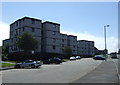
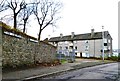
Housing at Balnagask
Mixture of flats and different housing types at Balnagask, Aberdeen
Image: © Lizzie
Taken: 30 Jul 2004
0.02 miles
2
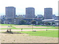
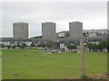
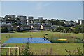
Balnagask Housing Estate
1960s development of low and high rise houses in south-eastern Aberdeen. In the foreground is the park by the ruined St Fittick's Church.
Image: © Colin Smith
Taken: 10 Aug 2009
0.13 miles
6
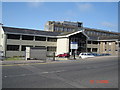
F.R.S. Torry Research Lab
The Fisheries Research Service, Torry Research Laboratory. Picture taken from Victoria Road
Image: © George Wilson
Taken: 19 Aug 2006
0.22 miles
7
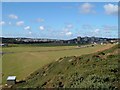
The Vale of Tullos 2004
Taken from the top of a Kame in September (gorse not in bloom). Note how well clipped the grass is.
Image: © Peter Robinson
Taken: Unknown
0.22 miles
8
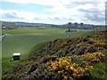
Vale of Tullos in May 2009
Note the Gorse is out and a new woodland has been planted to the left of the photo
Image: © Peter Robinson
Taken: Unknown
0.23 miles
9
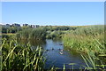
Urban wetland
Ducks swim in the wetlands at St Fittick's Community Park with the tower blocks of Balnagask in the background. Balnagask means 'town on a long tail of land' according to Celtic Placenames of Aberdeenshire by John Milne.
Image: © Bill Harrison
Taken: 31 Aug 2020
0.23 miles