Disused quarries, Rhyd y Foel
Introduction
The photograph on this page of Disused quarries, Rhyd y Foel by Jonathan Wilkins as part of the Geograph project.
The Geograph project started in 2005 with the aim of publishing, organising and preserving representative images for every square kilometre of Great Britain, Ireland and the Isle of Man.

There are currently over 7.5m images from over 14,400 individuals and you can help contribute to the project by visiting https://www.geograph.org.uk
Disused quarries, Rhyd y Foel
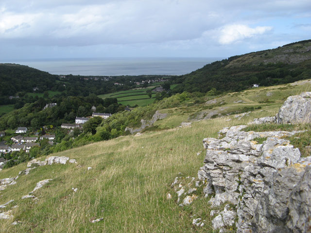
Image: © Jonathan Wilkins Taken: 2 Sep 2008
The outcrop of Carboniferous Limestone has been exploited here for a very long time, as indicated by the dark grey colour of the rock faces in the middle distance, and the mature trees covering the heaps of spoil thrown down the hill towards the village.
Images are licensed for reuse under creativecommons.org/licenses/by-sa/2.0
Image Location
Latitude
53.27494
Longitude
-3.631118