Fire in Hurst Road
Introduction
The photograph on this page of Fire in Hurst Road by Andy Potter as part of the Geograph project.
The Geograph project started in 2005 with the aim of publishing, organising and preserving representative images for every square kilometre of Great Britain, Ireland and the Isle of Man.

There are currently over 7.5m images from over 14,400 individuals and you can help contribute to the project by visiting https://www.geograph.org.uk
Fire in Hurst Road
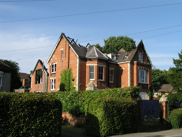
Image: © Andy Potter Taken: 29 Jul 2008
Image was sold in 2005 to property developers. Repeated applications to demolish this building of historic significance and replace it with flats were refused. On the night of Friday 18th July 2008 a fire severely damaged the first storey and roof. Fire investigation officers stated that the likely cause of the fire was arson and a police investigation will follow. This building is in the same grid square as Image which was probably a significant factor in it not being completely razed. No association between the developers and the fire should be inferred from the above comment.
Images are licensed for reuse under creativecommons.org/licenses/by-sa/2.0
Image Location
Latitude
51.071607
Longitude
-0.326434