Yelverton Shops
Introduction
The photograph on this page of Yelverton Shops by Tony Atkin as part of the Geograph project.
The Geograph project started in 2005 with the aim of publishing, organising and preserving representative images for every square kilometre of Great Britain, Ireland and the Isle of Man.

There are currently over 7.5m images from over 14,400 individuals and you can help contribute to the project by visiting https://www.geograph.org.uk
Yelverton Shops
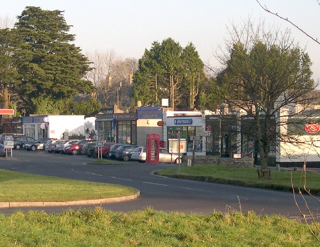
Image: © Tony Atkin Taken: 11 Dec 2005
These single storey buildings look quite curious. In fact they used to be taller but when the nearby RAF airfield was built in 1942 these buildings had their upper stories removed to stop them getting in the way of aircraft landing or taking off. Since this photograph was taken a new two storey building has been built in this row. See Image
Images are licensed for reuse under creativecommons.org/licenses/by-sa/2.0
Image Location


Leaflet Map data © OpenStreetMap
Latitude
50.491314
Longitude
-4.085008