View from Rateen farm, Mount Sedborough
Introduction
The photograph on this page of View from Rateen farm, Mount Sedborough by D Gore as part of the Geograph project.
The Geograph project started in 2005 with the aim of publishing, organising and preserving representative images for every square kilometre of Great Britain, Ireland and the Isle of Man.

There are currently over 7.5m images from over 14,400 individuals and you can help contribute to the project by visiting https://www.geograph.org.uk
View from Rateen farm, Mount Sedborough
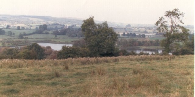
Image: © D Gore Taken: Unknown
The view from Mount Sedborough land (Rateen farm) over Mount Sedborough Lough towards Coolnamarrow, Mount Darby and Knockaraven. It was here at Mount Sedborough (originally the property of the Sedborough family of Porlock, Somerset) that the owner, John Mayne, was murdered in front of his family during the Irish rebellion of 1641 http://books.google.co.uk/books?id=2_ZstVBZSfIC&lpg=PA1&pg=PA108#v=onepage&q=&f=true Now, nearly four centuries later, the Mayne family are still present at Mount Sedborough. For the further history of Mount Sedborough see Image or Image
Images are licensed for reuse under creativecommons.org/licenses/by-sa/2.0
Image Location


Leaflet Map data © OpenStreetMap
Latitude
54.224711
Longitude
-7.3125