Wrest Park: The Clock Tower
Introduction
The photograph on this page of Wrest Park: The Clock Tower by Nigel Cox as part of the Geograph project.
The Geograph project started in 2005 with the aim of publishing, organising and preserving representative images for every square kilometre of Great Britain, Ireland and the Isle of Man.

There are currently over 7.5m images from over 14,400 individuals and you can help contribute to the project by visiting https://www.geograph.org.uk
Wrest Park: The Clock Tower
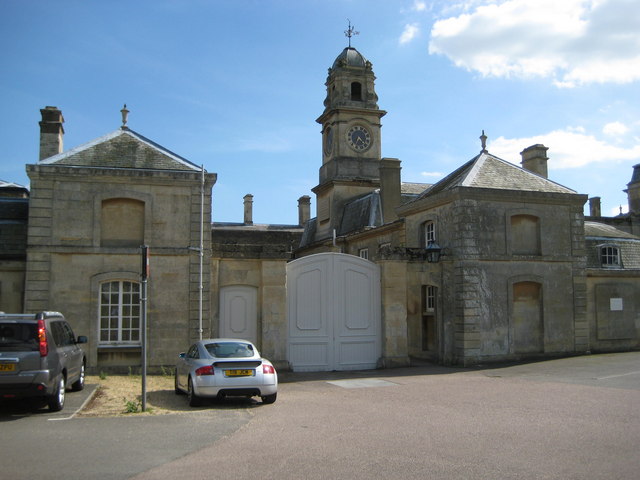
Image: © Nigel Cox Taken: 30 Jun 2008
The Clock Tower is to the east of the main house and overlooks the former stables and offices block. A tablet on the tower reads: THE FIRST STONE OF THIS BVILDING WAS LAID BY THOMAS PHILIP EARL DE GREY ON THE XIITH DAY OF FEBRVARY MDCCCXXXIV
Images are licensed for reuse under creativecommons.org/licenses/by-sa/2.0
Image Location
Latitude
52.008011
Longitude
-0.41046