NCN 45 and a strange benchmark
Introduction
The photograph on this page of NCN 45 and a strange benchmark by Richard Webb as part of the Geograph project.
The Geograph project started in 2005 with the aim of publishing, organising and preserving representative images for every square kilometre of Great Britain, Ireland and the Isle of Man.

There are currently over 7.5m images from over 14,400 individuals and you can help contribute to the project by visiting https://www.geograph.org.uk
NCN 45 and a strange benchmark
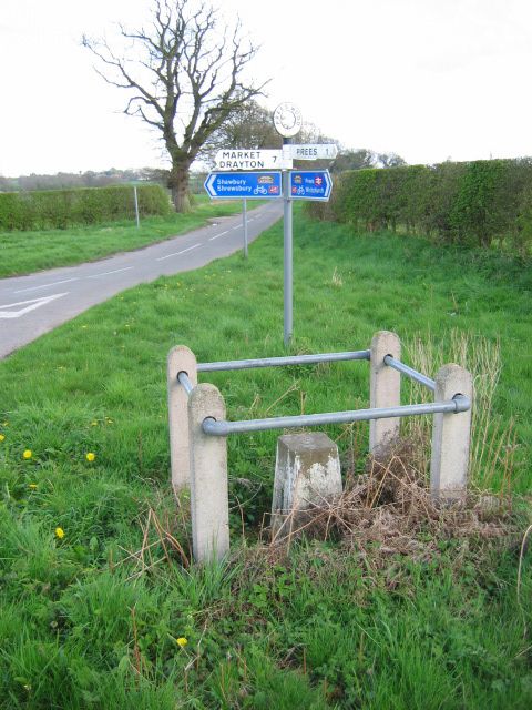
Image: © Richard Webb Taken: 19 Apr 2004
The enclosure surrounds a benchmark, for levelling purposes. Usually these are stone blocks, but in this case it is a sort of half scale triangulation pillar. This is one of two pairs used for gravity measurements.
Images are licensed for reuse under creativecommons.org/licenses/by-sa/2.0
Image Location


Leaflet Map data © OpenStreetMap
Latitude
52.897772
Longitude
-2.637089