Guide Bridge West Junction
Introduction
The photograph on this page of Guide Bridge West Junction by Peter Whatley as part of the Geograph project.
The Geograph project started in 2005 with the aim of publishing, organising and preserving representative images for every square kilometre of Great Britain, Ireland and the Isle of Man.

There are currently over 7.5m images from over 14,400 individuals and you can help contribute to the project by visiting https://www.geograph.org.uk
Guide Bridge West Junction
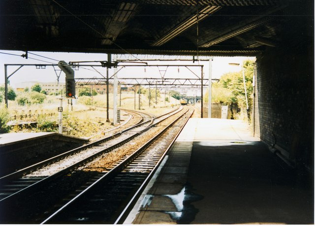
Image: © Peter Whatley Taken: 2 Jul 1988
The remaining connection at the west end of the station, leading off to Stockport. Until the early 1980s, this was a four-track railway, with multi-track junctions both left and right, all busy with freight. Recession, heavy industry's decline and catastrophic railway strikes in 1982 and 1984 changed the infrastructure utterly. For a view 25 years on, see: http://www.geograph.org.uk/photo/3676972.
Images are licensed for reuse under creativecommons.org/licenses/by-sa/2.0
Image Location


Leaflet Map data © OpenStreetMap
Latitude
53.474265
Longitude
-2.115367