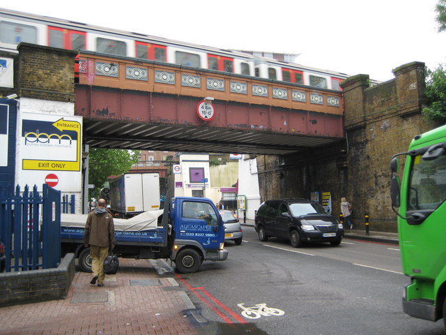
Putney: A205 South Circular Road
Introduction
The photograph on this page of Putney: A205 South Circular Road by Nigel Cox as part of the Geograph project.
The Geograph project started in 2005 with the aim of publishing, organising and preserving representative images for every square kilometre of Great Britain, Ireland and the Isle of Man.
There are currently over 7.5m images from over 14,400 individuals and you can help contribute to the project by visiting https://www.geograph.org.uk

Image: © Nigel Cox Taken: 28 May 2008
In true GCSE examination style compare and contrast this with Image! To the stranger the names South and North Circular Roads might imply a sense of commonality, but... I can do no better than quote from the opening lines of the excellent SABRE http://www.sabre-roads.org.uk/ website's description of the A205: "Welcome to the largest collection of signposts in the country. London’s South Circular Road, unlike its northern counterpart, is not so much a coherent through route, more an intricate series of one way systems linked by short lengths of suburban streets. Route-finding is a nightmare, with odd turnings down unlikely-looking side streets occurring when you least expect them. Very few people attempt (still less achieve) the journey end-to-end – it is usually quicker, despite the extra distance, to use the North Circular Road, or just to go straight through the middle of London! Most regular drivers in South London have go-arounds using quiet back streets to avoid the worst stretches – most of these (including mine!) are jealously guarded secrets." Here, not only is the road narrow, but it passes under the 15' 0" height restriction of London Underground's District Line bridge next to East Putney station. Between East Putney station and the Fulham Railway Bridge the District Line railway passes over 5 roads each with a distinctive metal box bridge. See Image Image Image Image for the others.

