Ruin of St John's Church at Victoria Street and James Street junction
Introduction
The photograph on this page of Ruin of St John's Church at Victoria Street and James Street junction by Roger Templeman as part of the Geograph project.
The Geograph project started in 2005 with the aim of publishing, organising and preserving representative images for every square kilometre of Great Britain, Ireland and the Isle of Man.

There are currently over 7.5m images from over 14,400 individuals and you can help contribute to the project by visiting https://www.geograph.org.uk
Ruin of St John's Church at Victoria Street and James Street junction
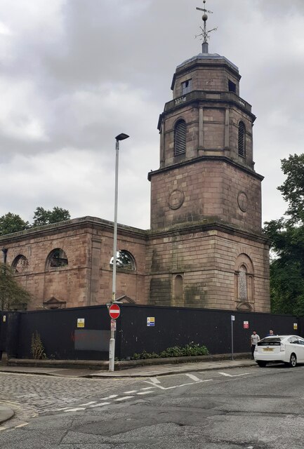
Image: © Roger Templeman Taken: 20 Jul 2024
Old maps show that the spire was an intersected station trig point and other documents indicate that a 1GL bolt benchmark levelled at 115.507m above Newlyn Datum was verified in 1956 on the right hand face of the tower. The building, regarded as dangerous, is currently fenced off so not possible to check the benchmark
Images are licensed for reuse under creativecommons.org/licenses/by-sa/2.0
Image Location
Latitude
53.750636
Longitude
-2.482354