Pavement map in Durham city
Introduction
The photograph on this page of Pavement map in Durham city by Trevor Littlewood as part of the Geograph project.
The Geograph project started in 2005 with the aim of publishing, organising and preserving representative images for every square kilometre of Great Britain, Ireland and the Isle of Man.

There are currently over 7.5m images from over 14,400 individuals and you can help contribute to the project by visiting https://www.geograph.org.uk
Pavement map in Durham city
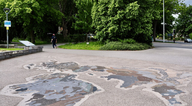
Image: © Trevor Littlewood Taken: 9 Jun 2024
This is close to the Bill Bryson Library at Durham University. It's a geological map of the UK and Ireland with rock types indicated by actual specimens cut to the necessary shape. It's not known whether for example the granite specimen for the Goat Fell area of Arran actually came from that location, or if 'generic' specimens were used.
Images are licensed for reuse under creativecommons.org/licenses/by-sa/2.0
Image Location
Latitude
54.768578
Longitude
-1.573936