Old Milestone by the A4135, Kingscote Park, Kingscote parish
Introduction
The photograph on this page of Old Milestone by the A4135, Kingscote Park, Kingscote parish by Roadside Relics as part of the Geograph project.
The Geograph project started in 2005 with the aim of publishing, organising and preserving representative images for every square kilometre of Great Britain, Ireland and the Isle of Man.

There are currently over 7.5m images from over 14,400 individuals and you can help contribute to the project by visiting https://www.geograph.org.uk
Old Milestone by the A4135, Kingscote Park, Kingscote parish
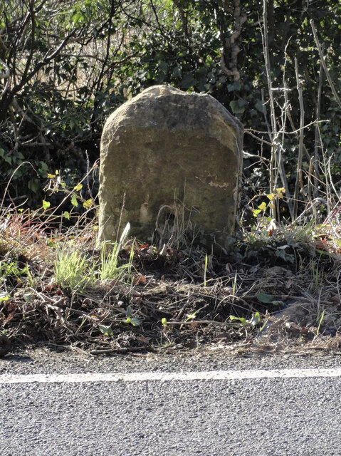
Image: © Roadside Relics Taken: 12 Feb 2024
Stone post (plate lost) by the A4135, in parish of KINGSCOTE (COTSWOLD District), by the road, on South side of road. TDW iron plate, erected by the Coldharbour District turnpike trust in the 19th century. Inscription once read:- (TETBURY) (5) (DURSLEY) (&) (WOTTON) (5) Grade II listed. List Entry Number: 1153577 https://historicengland.org.uk/listing/the-list/list-entry/1153577 Milestone Society National ID: GL_TBDY05.
Images are licensed for reuse under creativecommons.org/licenses/by-sa/2.0
Image Location
Latitude
51.66023
Longitude
-2.266437