Ruined Farmstead known as Hannah in Simpson Cross
Introduction
The photograph on this page of Ruined Farmstead known as Hannah in Simpson Cross by Deborah Tilley as part of the Geograph project.
The Geograph project started in 2005 with the aim of publishing, organising and preserving representative images for every square kilometre of Great Britain, Ireland and the Isle of Man.

There are currently over 7.5m images from over 14,400 individuals and you can help contribute to the project by visiting https://www.geograph.org.uk
Ruined Farmstead known as Hannah in Simpson Cross
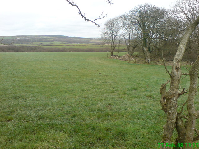
Image: © Deborah Tilley Taken: 25 Feb 2008
In the copse to the right lies piles of stones - all that remains of 'Hannah' a farmstead occupied for decades in the 19th century by the Meyler family. Hannah is mentioned in works kept in the National Library of Wales and was first made mention of in the 14th century when it was known as Haen Hoc (meaning High Hook) It eventually changed into Hannah over the centuries but disappeared by about 1900.In the distance lies Plumstone Mountain.
Images are licensed for reuse under creativecommons.org/licenses/by-sa/2.0
Image Location
Latitude
51.836786
Longitude
-5.066249