Railway bridge strike plate
Introduction
The photograph on this page of Railway bridge strike plate by Bill Kasman as part of the Geograph project.
The Geograph project started in 2005 with the aim of publishing, organising and preserving representative images for every square kilometre of Great Britain, Ireland and the Isle of Man.

There are currently over 7.5m images from over 14,400 individuals and you can help contribute to the project by visiting https://www.geograph.org.uk
Railway bridge strike plate
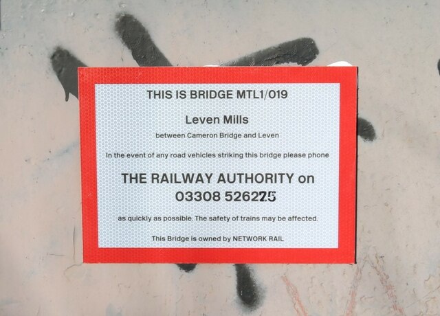
Image: © Bill Kasman Taken: 3 Feb 2024
These plates identify bridges carrying either a railway over a road or a road over a railway. The plate also carries information on what to do in the event of a bridge being struck by a road vehicle. This particular plate is on this bridge https://www.geograph.org.uk/photo/7442626 which carries a footpath over the (currently under construction) Levenmouth Rail Link https://www.railway-technology.com/projects/levenmouth-rail-link-project-fife-scotland/ Not all such bridges carry one of these plates - if in doubt contact the police.
Images are licensed for reuse under creativecommons.org/licenses/by-sa/2.0
Image Location
Latitude
56.194874
Longitude
-3.009739