Gaulter Cottages across Gaulter Gap
Introduction
The photograph on this page of Gaulter Cottages across Gaulter Gap by Jim Champion as part of the Geograph project.
The Geograph project started in 2005 with the aim of publishing, organising and preserving representative images for every square kilometre of Great Britain, Ireland and the Isle of Man.

There are currently over 7.5m images from over 14,400 individuals and you can help contribute to the project by visiting https://www.geograph.org.uk
Gaulter Cottages across Gaulter Gap
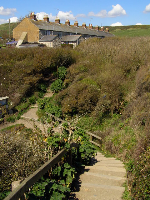
Image: © Jim Champion Taken: 16 Apr 2008
The steps in the foreground lead down from the car park to a bridge across the stream that flows down from Kimmeridge into the bay. The left turn leads down to the beach in Kimmeridge Bay, the right turn leads up more steps to Gaulter Cottages. The practice of spreading shale-ash (and the contents of cess-pits) on plots as a fertiliser was called 'gaulting', and gave the Gaulter Gap its name. The shale from the local cliffs was burnt as fuel, known as 'Kimmeridge coal'.
Images are licensed for reuse under creativecommons.org/licenses/by-sa/2.0
Image Location


Leaflet Map data © OpenStreetMap
Latitude
50.612079
Longitude
-2.131245