
Houses beside the B1110 (Holt Road)
Introduction
The photograph on this page of Houses beside the B1110 (Holt Road) by Evelyn Simak as part of the Geograph project.
The Geograph project started in 2005 with the aim of publishing, organising and preserving representative images for every square kilometre of Great Britain, Ireland and the Isle of Man.

There are currently over 7.5m images from over 14,400 individuals and you can help contribute to the project by visiting https://www.geograph.org.uk
Houses beside the B1110 (Holt Road)
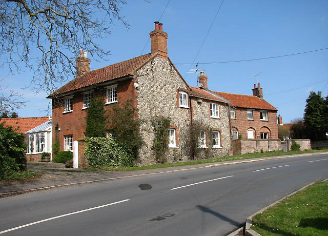
Image: © Evelyn Simak Taken: 14 Apr 2008
The village of Thornage is situated in the Glaven Valley conservation area, the largest conservation area in the county. Many of the houses are listed buildings and are being preserved as of historical interest. Ornamental and reinforcing ironwork, which can be observed attached to the walls of a number of houses and cottages, bear witness of the occupation of many of the villagers, several hundred years ago, earning their living with the manufacture and repair of agricultural tools and implements.
Images are licensed for reuse under creativecommons.org/licenses/by-sa/2.0
Image Location

Latitude
52.885052
Longitude
1.046033