Stevenage HM Land Registry (Former Offices)
Introduction
The photograph on this page of Stevenage HM Land Registry (Former Offices) by Andy Steele as part of the Geograph project.
The Geograph project started in 2005 with the aim of publishing, organising and preserving representative images for every square kilometre of Great Britain, Ireland and the Isle of Man.

There are currently over 7.5m images from over 14,400 individuals and you can help contribute to the project by visiting https://www.geograph.org.uk
Stevenage HM Land Registry (Former Offices)
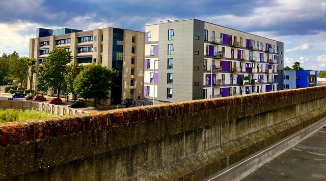
Image: © Andy Steele Taken: 2 Sep 2023
Located on Swingate/Danestrete in Stevenage Town Centre. Originally built in 1966 as Brickdale House for the HM Land Registry until closing in 2011, converted and refurbished into 150 Flats and renamed to Skyline House opening in 2017 for residential use.
Images are licensed for reuse under creativecommons.org/licenses/by-sa/2.0
Image Location
Latitude
51.902641
Longitude
-0.204862