Bridge over the River Leven
Introduction
The photograph on this page of Bridge over the River Leven by Mick Garratt as part of the Geograph project.
The Geograph project started in 2005 with the aim of publishing, organising and preserving representative images for every square kilometre of Great Britain, Ireland and the Isle of Man.

There are currently over 7.5m images from over 14,400 individuals and you can help contribute to the project by visiting https://www.geograph.org.uk
Bridge over the River Leven
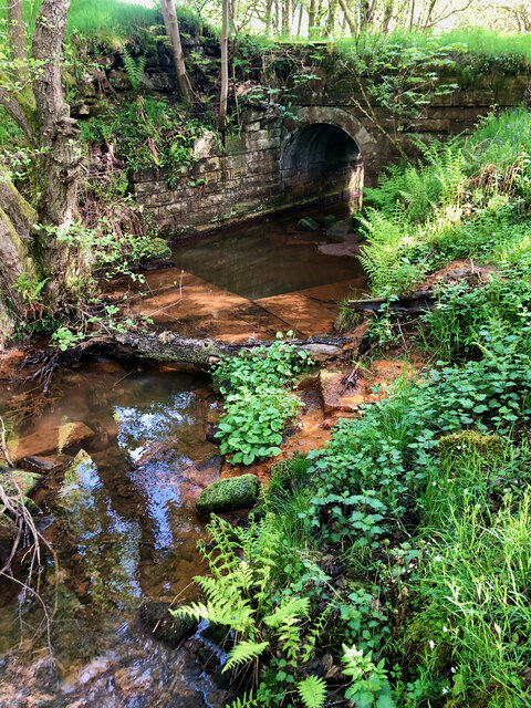
Image: © Mick Garratt Taken: 17 May 2023
Just before the earth bank remains of the dam wall to the old fishpond, the footpath crossed this exceedingly well constructed bridge over the Leven. Initially, I assumed its connection to the old dam, but after carefully examining the old O.S. maps, I have come to the conclusion that its intended function was probably to serve as a railway siding that led to a nearby whinstone quarry. Who knew there was a quarry this far up Kildale? It must have had a brief existence. The 1853 map offers no hint of its presence, and by 1893, only the remnants of earthworks are depicted, indicating that the quarry had been long abandoned. For sources see my blog post http://www.fhithich.uk/?p=32148
Images are licensed for reuse under creativecommons.org/licenses/by-sa/2.0
Image Location
Latitude
54.480053
Longitude
-1.034445