Donnington Manor
Introduction
The photograph on this page of Donnington Manor by Philip Halling as part of the Geograph project.
The Geograph project started in 2005 with the aim of publishing, organising and preserving representative images for every square kilometre of Great Britain, Ireland and the Isle of Man.

There are currently over 7.5m images from over 14,400 individuals and you can help contribute to the project by visiting https://www.geograph.org.uk
Donnington Manor
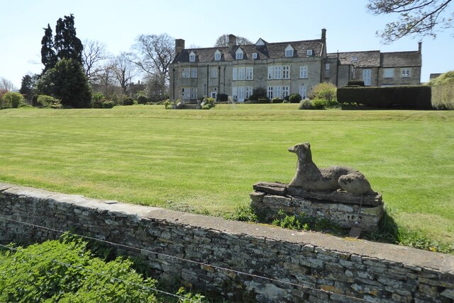
Image: © Philip Halling Taken: 20 Apr 2023
Surprisingly this impressive manor house doesn't appear to be listed. This is a recreation of the first picture uploaded in this grid square by me in January 2006 Image Here the house is viewed from the Monarch's Way.
Images are licensed for reuse under creativecommons.org/licenses/by-sa/2.0
Image Location
Latitude
51.953218
Longitude
-1.720284