Turnover Bridge - the horsey bit, Pendeford
Introduction
The photograph on this page of Turnover Bridge - the horsey bit, Pendeford by Roger Kidd as part of the Geograph project.
The Geograph project started in 2005 with the aim of publishing, organising and preserving representative images for every square kilometre of Great Britain, Ireland and the Isle of Man.

There are currently over 7.5m images from over 14,400 individuals and you can help contribute to the project by visiting https://www.geograph.org.uk
Turnover Bridge - the horsey bit, Pendeford
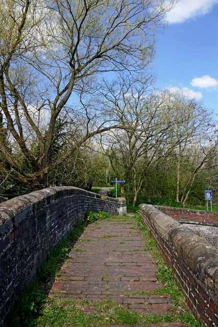
Image: © Roger Kidd Taken: 8 Apr 2023
These are sometimes called double bridges, but here it also functioned as a turnover bridge, enabling horses to cross from one side of the canal to the other without being unhitched from their boats, so it is named Turnover Bridge, No 3 across the Shropshire Union Canal. It is open to pedestrians and cyclists. This image shows the narrower horse crossing section. Off to the left is the adjacent farm road crossing. See Image] Looking north, the unusual Grade II listed "two lane" structure served two purposes, and was probably only built this way to satisfy local landowners at the time. The wider section off to the left carried a substantial track between Barnhurst Farm and (Upper) Pendeford Farm. Barnhurst Farm has been demolished and land used for the Dovecotes housing estate. The track leading north-west to Pendeford Farm, across the current Pendeford Wood nature area, no longer exists.
Images are licensed for reuse under creativecommons.org/licenses/by-sa/2.0
Image Location
Latitude
52.622137
Longitude
-2.159049