Old Boundary Marker on the A367 Roman Road
Introduction
The photograph on this page of Old Boundary Marker on the A367 Roman Road by Roadside Relics as part of the Geograph project.
The Geograph project started in 2005 with the aim of publishing, organising and preserving representative images for every square kilometre of Great Britain, Ireland and the Isle of Man.

There are currently over 7.5m images from over 14,400 individuals and you can help contribute to the project by visiting https://www.geograph.org.uk
Old Boundary Marker on the A367 Roman Road
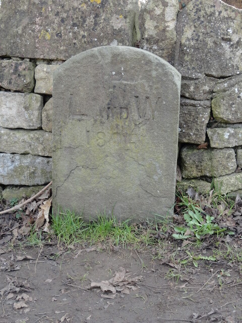
Image: © Roadside Relics Taken: 2 Mar 2023
Parish Boundary Marker on the southwest side of the A367 Roman Road southwest of the junction with Combe Hay Road. Immediately to the northeast of SO_BARA03bpb. Combe Hay parish. Inscribed P / L AND W / 1894 and on the former boundary of Lyncombe with Widcombe parish. Grade II Listed details https://historicengland.org.uk/listing/the-list/list-entry/1320808. See also https://www.geograph.org.uk/photo/5655340. Milestone Society National ID: SO_WID07pb
Images are licensed for reuse under creativecommons.org/licenses/by-sa/2.0
Image Location
Latitude
51.354387
Longitude
-2.382571