Old Bridge Marker on the A659
Introduction
The photograph on this page of Old Bridge Marker on the A659 by C Minto as part of the Geograph project.
The Geograph project started in 2005 with the aim of publishing, organising and preserving representative images for every square kilometre of Great Britain, Ireland and the Isle of Man.

There are currently over 7.5m images from over 14,400 individuals and you can help contribute to the project by visiting https://www.geograph.org.uk
Old Bridge Marker on the A659
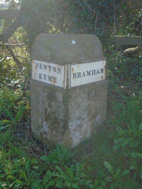
Image: © C Minto Taken: 19 Mar 2023
Parish Boundary Marker on the south side of the junction of the A659 and St Andrews Walk. On the boundary of Bramham cum Oglethorpe and Newton Kyme parishes, both in the West Riding until 1974, but now West Yorkshire and North Yorkshire. The plates have been repainted since https://www.geograph.org.uk/photo/6049104. Milestone Society National ID: YW_TCOT02pb
Images are licensed for reuse under creativecommons.org/licenses/by-sa/2.0
Image Location
Latitude
53.89692
Longitude
-1.317875