Tanfield Lea Park Rookery
Introduction
The photograph on this page of Tanfield Lea Park Rookery by Robert Graham as part of the Geograph project.
The Geograph project started in 2005 with the aim of publishing, organising and preserving representative images for every square kilometre of Great Britain, Ireland and the Isle of Man.

There are currently over 7.5m images from over 14,400 individuals and you can help contribute to the project by visiting https://www.geograph.org.uk
Tanfield Lea Park Rookery
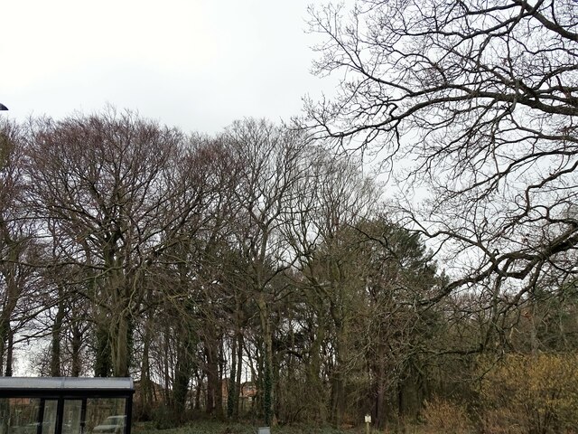
Image: © Robert Graham Taken: 6 Mar 2023
This is in reality a small wood, beside the B6173 which runs through the village. The most notable thing about this picture is something which is missing, and that is the Rooks nests. For as many years as I can remember, and that goes back to the 1950's, there was a large rookery in these trees. The birds would have been already back at their nests at this time in the early spring, but there are none now. Also, the old nests from previous years would have been in the tree tops, which means that the rookery must have been deserted from a year or so before this year. Rook numbers have been falling locally, and this is proof.
Images are licensed for reuse under creativecommons.org/licenses/by-sa/2.0
Image Location
Latitude
54.881047
Longitude
-1.712872