Benchmark. Cut mark, North junction of Cockett Road and Saint Peters Terrace
Introduction
The photograph on this page of Benchmark. Cut mark, North junction of Cockett Road and Saint Peters Terrace by John Jenkins as part of the Geograph project.
The Geograph project started in 2005 with the aim of publishing, organising and preserving representative images for every square kilometre of Great Britain, Ireland and the Isle of Man.

There are currently over 7.5m images from over 14,400 individuals and you can help contribute to the project by visiting https://www.geograph.org.uk
Benchmark. Cut mark, North junction of Cockett Road and Saint Peters Terrace
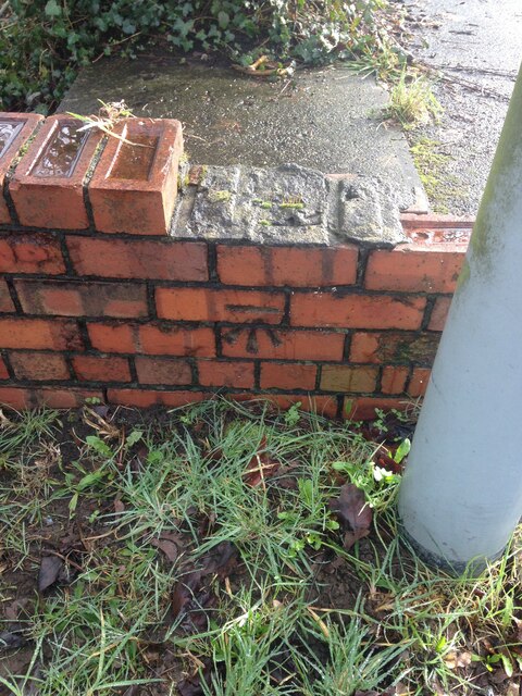
Image: © John Jenkins Taken: 21 Feb 2023
Cut mark can be found at the junction of Cockett Road and Saint Peters Terrace on a red bricked wall surrounding steps.
Images are licensed for reuse under creativecommons.org/licenses/by-sa/2.0
Image Location
Latitude
51.636274
Longitude
-3.980462