White Cross, Hereford, market/plague cross
Introduction
The photograph on this page of White Cross, Hereford, market/plague cross by Mr Red as part of the Geograph project.
The Geograph project started in 2005 with the aim of publishing, organising and preserving representative images for every square kilometre of Great Britain, Ireland and the Isle of Man.

There are currently over 7.5m images from over 14,400 individuals and you can help contribute to the project by visiting https://www.geograph.org.uk
White Cross, Hereford, market/plague cross
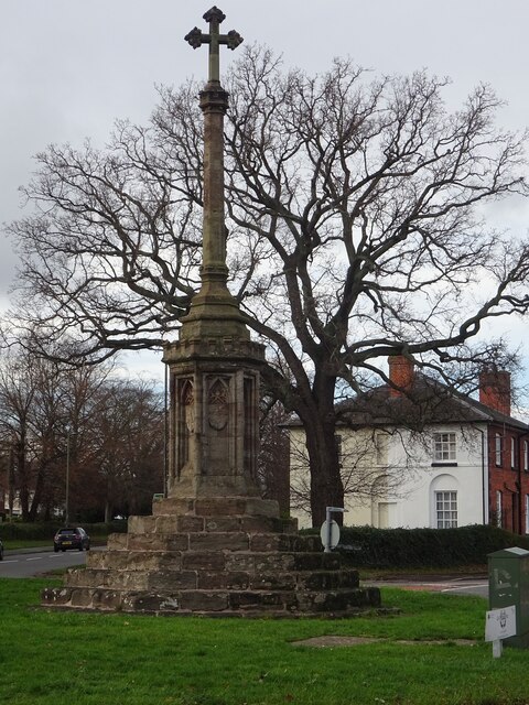
Image: © Mr Red Taken: 14 Jan 2023
At the junction of: Whitecross, King's Acre, Yazor and Three Elms Roads. It was erected in 1361-70 to commemorate the re‑location of the market 1½ miles out of the city during the plague. Read more at https://britishlistedbuildings.co.uk/101196892-white-cross-hereford#.Y8kFvq3P1PY It is 61.3m Above Sea Level. Other views include http://www.geograph.org.uk/photo/6334549 , http://www.geograph.org.uk/photo/1755707 , http://www.geograph.org.uk/photo/4276499 , http://www.geograph.org.uk/photo/1755709 & http://www.geograph.org.uk/photo/231512. Milestone Society National ID: HFHF_HER
Images are licensed for reuse under creativecommons.org/licenses/by-sa/2.0
Image Location
Latitude
52.062021
Longitude
-2.740781