Mill Cottage, Coundarbour
Introduction
The photograph on this page of Mill Cottage, Coundarbour by Andrew Abbott as part of the Geograph project.
The Geograph project started in 2005 with the aim of publishing, organising and preserving representative images for every square kilometre of Great Britain, Ireland and the Isle of Man.

There are currently over 7.5m images from over 14,400 individuals and you can help contribute to the project by visiting https://www.geograph.org.uk
Mill Cottage, Coundarbour
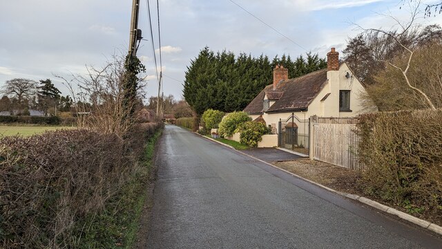
Image: © Andrew Abbott Taken: 20 Dec 2022
The Grade II listed Mill Cottage, Coundarbour. Official listing (https://historicengland.org.uk/listing/the-list/list-entry/1366719?section=official-list-entry) states: II Cottage. Probably early to mid-C17 with mid-C20 addition and alterations. Rendered timber frame and masonry; plain tile roof. Two framed bays with addition. Central gabled eaves dormer with two-light diamond-leaded casement; one C17 and one C20 gabled eaves dormer at rear, both timber framed with C20 two-light diamond-leaded casements; brick ridge stack off-centre to left and C20 external brick end stack to left. Three-window front; C20 two- and three-light diamond-leaded casements and C20 hipped canted bay to right with diamond-leaded casements; boarded door between first and second windows from left with hipped timber porch.
Images are licensed for reuse under creativecommons.org/licenses/by-sa/2.0
Image Location


Leaflet Map data © OpenStreetMap
Latitude
52.644776
Longitude
-2.658382