101 - 105 and 107 Wandsworth Road
Introduction
The photograph on this page of 101 - 105 and 107 Wandsworth Road by Ian Capper as part of the Geograph project.
The Geograph project started in 2005 with the aim of publishing, organising and preserving representative images for every square kilometre of Great Britain, Ireland and the Isle of Man.

There are currently over 7.5m images from over 14,400 individuals and you can help contribute to the project by visiting https://www.geograph.org.uk
101 - 105 and 107 Wandsworth Road
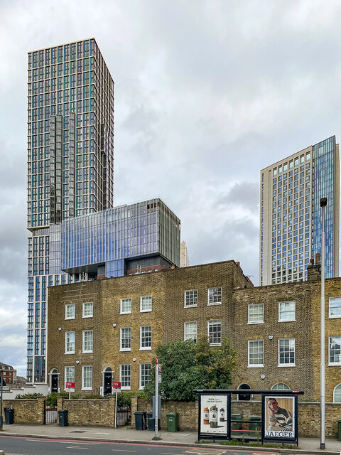
Image: © Ian Capper Taken: 7 Oct 2022
A remnant of old buildings among the modern redevelopment of the Vauxhall/Nine Elms area, dating from the early 19th Century, with nos 101 - 105 on the left and no 107 and part of no 109 on the right. Both sections are grade II listed - see https://historicengland.org.uk/listing/the-list/list-entry/1081046?section=official-list-entry and https://historicengland.org.uk/listing/the-list/list-entry/1357949?section=official-list-entry respectively. Behind on the left is Damac Tower Nine Elms, completed in 2021, and on the right is The Atlas, completed in 2018.
Images are licensed for reuse under creativecommons.org/licenses/by-sa/2.0
Image Location
Latitude
51.483517
Longitude
-0.12683