Chepstow houses [46]
Introduction
The photograph on this page of Chepstow houses [46] by Michael Dibb as part of the Geograph project.
The Geograph project started in 2005 with the aim of publishing, organising and preserving representative images for every square kilometre of Great Britain, Ireland and the Isle of Man.

There are currently over 7.5m images from over 14,400 individuals and you can help contribute to the project by visiting https://www.geograph.org.uk
Chepstow houses [46]
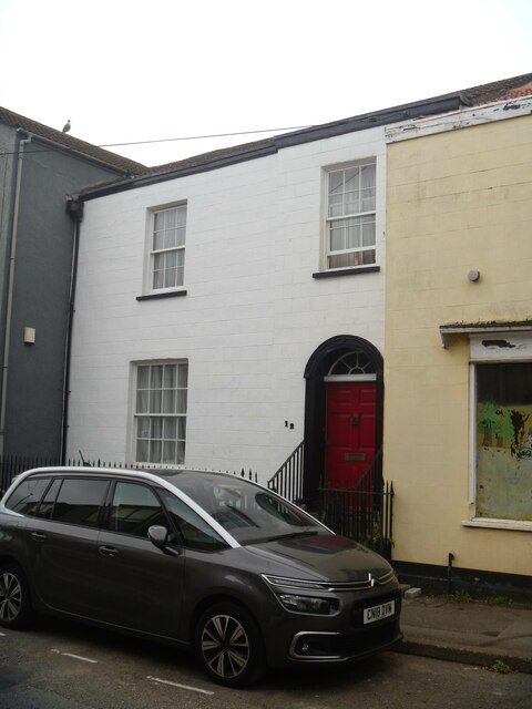
Image: © Michael Dibb Taken: 3 Sep 2022
Number 12 Lower Church Street was built in the early 19th century and originally included number 12A Image A coachworks was situated at the rear in the early to mid 19th century and, in the late 19th century, it was the home of the gasworks manager with access to the gasworks in a yard behind the street. Constructed of stuccoed Brick under a tile roof. There are cast iron railings to the forecourt and bordering the steps to the door. Listed, grade II, with details at: https://cadwpublic-api.azurewebsites.net/reports/listedbuilding/FullReport?lang=&id=2548 Chepstow, the most easterly town in Wales, is located on the tidal River Wye, some 3 miles above its confluence with the River Severn. There is evidence of continuous human occupation from the Mesolithic period. The town grew in importance when the Normans erected a castle at what was the lowest bridging point of the River Wye. The town flourished as a port, being exempt from English taxation, and it mainly traded in timber and bark from the Wye Valley. The town became an important centre for tourism from the late eighteenth century.
Images are licensed for reuse under creativecommons.org/licenses/by-sa/2.0
Image Location
Latitude
51.643745
Longitude
-2.670657