Olivers Mill Weir, River Wansbeck, Morpeth
Introduction
The photograph on this page of Olivers Mill Weir, River Wansbeck, Morpeth by Philip Soakell as part of the Geograph project.
The Geograph project started in 2005 with the aim of publishing, organising and preserving representative images for every square kilometre of Great Britain, Ireland and the Isle of Man.

There are currently over 7.5m images from over 14,400 individuals and you can help contribute to the project by visiting https://www.geograph.org.uk
Olivers Mill Weir, River Wansbeck, Morpeth
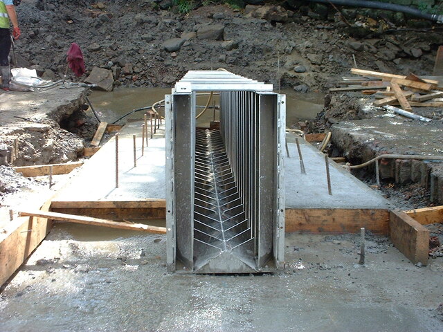
Image: © Philip Soakell Taken: 1 Sep 2000
Stainless steel fish pass assembled on its concrete base. The image shows the fins on the internal faces of the fish pass which create turbulence in the water to assist fish to get upstream of the weir.
Images are licensed for reuse under creativecommons.org/licenses/by-sa/2.0
Image Location
Latitude
55.165579
Longitude
-1.688543