Stone Stile SX0558
Introduction
The photograph on this page of Stone Stile SX0558 by Roger Smith as part of the Geograph project.
The Geograph project started in 2005 with the aim of publishing, organising and preserving representative images for every square kilometre of Great Britain, Ireland and the Isle of Man.

There are currently over 7.5m images from over 14,400 individuals and you can help contribute to the project by visiting https://www.geograph.org.uk
Stone Stile SX0558
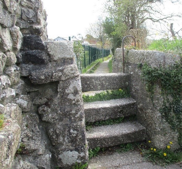
Image: © Roger Smith Taken: 19 Apr 2021
Near Luxulyan School. Open granite steps. Public footpath 408/15 from Bridges to Luxulyan Churchtown. On urban path connecting the 2 parts of Luxulyan footpath (408/15/1 and 408/15/2). The granite is local and appears by its regular shape and drill marks to have been quarried, suggesting a date from the mid-19th century, although the route could be much older because it connects the church town with the attached settlement of Bridges.
Images are licensed for reuse under creativecommons.org/licenses/by-sa/2.0
Image Location
Latitude
50.389919
Longitude
-4.744254