Old Hall Street, Wolverhampton
Introduction
The photograph on this page of Old Hall Street, Wolverhampton by Roger D Kidd as part of the Geograph project.
The Geograph project started in 2005 with the aim of publishing, organising and preserving representative images for every square kilometre of Great Britain, Ireland and the Isle of Man.

There are currently over 7.5m images from over 14,400 individuals and you can help contribute to the project by visiting https://www.geograph.org.uk
Old Hall Street, Wolverhampton
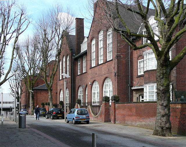
Image: © Roger D Kidd Taken: 19 Mar 2008
Now pedestrianized and smartened up with an open paved area with seats, granite sets and stainless steel bollards. Since long before I appeared on this scene (1970-ish) the street has been the centre of adult education in Wolverhampton, and so it remains. The main building of the Adult Education Service is on the right. A blue plaque can be seen on the wall recording the site as near to that of the Great Hall, demolished in 1883. Image] For a superb web-page about the "Old Hall" see here:http://www.localhistory.scit.wlv.ac.uk/articles/OldHall/Excavation.htm
Images are licensed for reuse under creativecommons.org/licenses/by-sa/2.0
Image Location
Latitude
52.583253
Longitude
-2.124815