Brough buildings [2]
Introduction
The photograph on this page of Brough buildings [2] by Michael Dibb as part of the Geograph project.
The Geograph project started in 2005 with the aim of publishing, organising and preserving representative images for every square kilometre of Great Britain, Ireland and the Isle of Man.

There are currently over 7.5m images from over 14,400 individuals and you can help contribute to the project by visiting https://www.geograph.org.uk
Brough buildings [2]
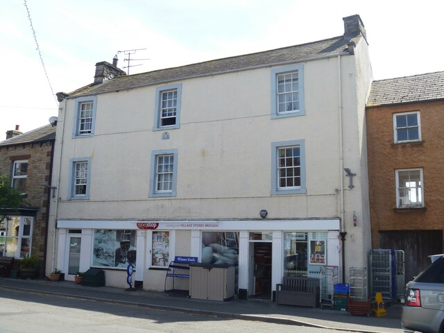
Image: © Michael Dibb Taken: 20 Jun 2022
This shop with living accommodation above is dated 1699 and has been altered later. Constructed of rendered rubble stone under a graduated slate roof. The shopfront is 20th century. Listed, grade II, with details at: https://historicengland.org.uk/listing/the-list/list-entry/1144911 Brough is a village in the Eden district of Cumbria, some 21 miles northeast of Kendal and about 30 miles west of Darlington. The village is on the A66 road, a key route across the Pennine Mountains via the Stainmore Pass. Brough is on the site of the Roman fort of Verterae and has the ruins of a Norman castle. The village has historically been divided into Market Brough, to the north, and Church Brough, to the south.
Images are licensed for reuse under creativecommons.org/licenses/by-sa/2.0
Image Location
Latitude
54.526426
Longitude
-2.318733