St. Cuthbert's Church, Bedlington
Introduction
The photograph on this page of St. Cuthbert's Church, Bedlington by Geoff Holland as part of the Geograph project.
The Geograph project started in 2005 with the aim of publishing, organising and preserving representative images for every square kilometre of Great Britain, Ireland and the Isle of Man.

There are currently over 7.5m images from over 14,400 individuals and you can help contribute to the project by visiting https://www.geograph.org.uk
St. Cuthbert's Church, Bedlington
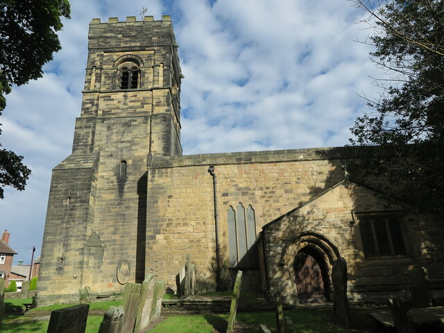
Image: © Geoff Holland Taken: 27 Sep 2022
This is the western elevation of this Grade II* Listed building, the nave of which dates back to the 12th Century. The chancel arch https://www.geograph.org.uk/photo/7296787 is, in the opinion of the editors of the Second Edition of Nikolaus Pevsner's book, 'The Buildings of England Northumberland', "an uncommonly interesting piece of late Norman building". A fair few alterations and additions have been made over the centuries.
Images are licensed for reuse under creativecommons.org/licenses/by-sa/2.0
Image Location
Latitude
55.129803
Longitude
-1.592998