Northiam buildings [3]
Introduction
The photograph on this page of Northiam buildings [3] by Michael Dibb as part of the Geograph project.
The Geograph project started in 2005 with the aim of publishing, organising and preserving representative images for every square kilometre of Great Britain, Ireland and the Isle of Man.

There are currently over 7.5m images from over 14,400 individuals and you can help contribute to the project by visiting https://www.geograph.org.uk
Northiam buildings [3]
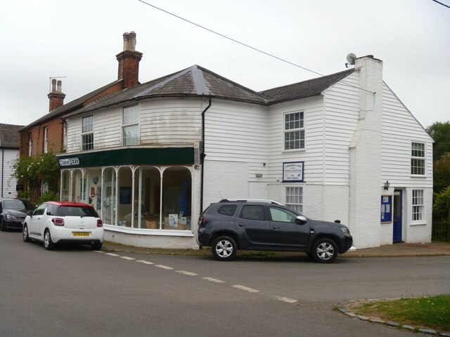
Image: © Michael Dibb Taken: 10 May 2022
Originally a house, now a shop and offices with a flat above. Built in the early 19th century and altered in the late 19th century. Constructed of painted brick with the first floor weatherboarded, all under a Welsh slate roof. The shopfront is late 19th century. There is another image of the building at Image Listed, for group value, grade II, with details at: https://historicengland.org.uk/listing/the-list/list-entry/1274135 Northiam is a large village in the valley of the River Rother, East Sussex, some 10 miles north of Hastings. The village sits astride the A28 road from Canterbury to Hastings. Queen Elizabeth I stopped in the village for a meal and left behind a pair of green damask shoes. In May 1944, just before D-Day, the Prime Ministers of four countries inspected the troops of Southern Command on the village playing fields. Great Dixter House and gardens form the western edge of the village.
Images are licensed for reuse under creativecommons.org/licenses/by-sa/2.0
Image Location
Latitude
50.994488
Longitude
0.59951