The Peacock
Introduction
The photograph on this page of The Peacock by Ian Capper as part of the Geograph project.
The Geograph project started in 2005 with the aim of publishing, organising and preserving representative images for every square kilometre of Great Britain, Ireland and the Isle of Man.

There are currently over 7.5m images from over 14,400 individuals and you can help contribute to the project by visiting https://www.geograph.org.uk
The Peacock
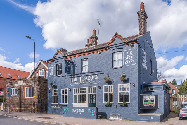
Image: © Ian Capper Taken: 14 Mar 2022
A locally listed pub on Hatfield Road. In a couple of years between 2007 and 2009 it went through various name changes: O'Neills, Ryans then back to O'Neills. It has now reverted to its original name, The Peacock. A 1634 map shows an Inn called The Peacock on the site, although the current building is clearly more recent, dating from the late 19th/early 20th century. Compare Image for how it looked in 2011.
Images are licensed for reuse under creativecommons.org/licenses/by-sa/2.0
Image Location
Latitude
51.754015
Longitude
-0.333261