No 8, Upton Magna
Introduction
The photograph on this page of No 8, Upton Magna by Richard Law as part of the Geograph project.
The Geograph project started in 2005 with the aim of publishing, organising and preserving representative images for every square kilometre of Great Britain, Ireland and the Isle of Man.

There are currently over 7.5m images from over 14,400 individuals and you can help contribute to the project by visiting https://www.geograph.org.uk
No 8, Upton Magna
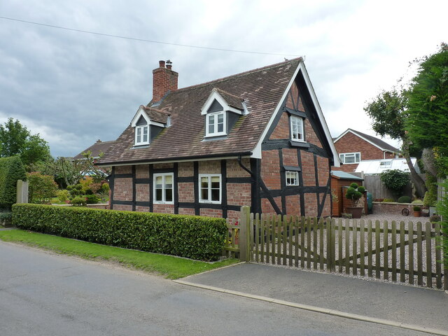
Image: © Richard Law Taken: 21 Jul 2020
Dating mainly from the 17th century, but with extensive 20th century additions and alterations, including the dormer windows. There is apparently a cruck truss construction supporting the roof internally, which is not visible from the outside. Grade II listed https://britishlistedbuildings.co.uk/101239510-8-upton-magna-upton-magna#.YjwkQ-fP02w & https://historicengland.org.uk/listing/the-list/list-entry/1239510 in 1972.
Images are licensed for reuse under creativecommons.org/licenses/by-sa/2.0
Image Location
Latitude
52.709486
Longitude
-2.661428