Balancing pond in Churchill
Introduction
The photograph on this page of Balancing pond in Churchill by Neil Owen as part of the Geograph project.
The Geograph project started in 2005 with the aim of publishing, organising and preserving representative images for every square kilometre of Great Britain, Ireland and the Isle of Man.

There are currently over 7.5m images from over 14,400 individuals and you can help contribute to the project by visiting https://www.geograph.org.uk
Balancing pond in Churchill
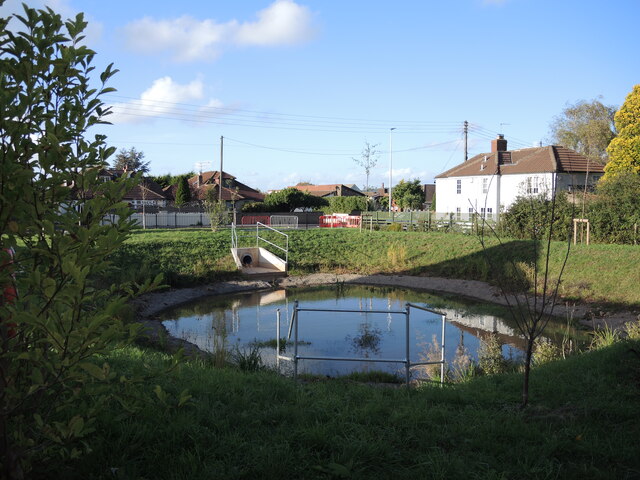
Image: © Neil Owen Taken: 1 Oct 2021
With the substantial increase in new housing in Churchill largely centred around the main Bristol Road, provision has been made for water management. This spot is at the lower end of the development and the pond is there to cope with excessive rainfall. Notably, there is no old stream in this area, just farm fields previously.
Images are licensed for reuse under creativecommons.org/licenses/by-sa/2.0
Image Location
Latitude
51.338707
Longitude
-2.78463