Watery Lane is cut off
Introduction
The photograph on this page of Watery Lane is cut off by Neil Owen as part of the Geograph project.
The Geograph project started in 2005 with the aim of publishing, organising and preserving representative images for every square kilometre of Great Britain, Ireland and the Isle of Man.

There are currently over 7.5m images from over 14,400 individuals and you can help contribute to the project by visiting https://www.geograph.org.uk
Watery Lane is cut off
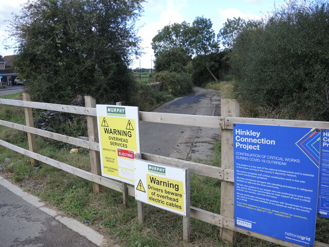
Image: © Neil Owen Taken: 29 Sep 2021
The old lane is now isolated and divided by the construction of an access road to the groundworks beyond. New electricity cables are being driven across Somerset, mainly underground. Watery Lane has been largely made redundant after Hanham Way was built for the housing estate that has sprung up here. The latter lies parallel and a very short distance from it.
Images are licensed for reuse under creativecommons.org/licenses/by-sa/2.0
Image Location
Latitude
51.431445
Longitude
-2.779745