Capel Cwmsarnddu / Cwmsarnddu Chapel
Introduction
The photograph on this page of Capel Cwmsarnddu / Cwmsarnddu Chapel by Alan Richards as part of the Geograph project.
The Geograph project started in 2005 with the aim of publishing, organising and preserving representative images for every square kilometre of Great Britain, Ireland and the Isle of Man.

There are currently over 7.5m images from over 14,400 individuals and you can help contribute to the project by visiting https://www.geograph.org.uk
Capel Cwmsarnddu / Cwmsarnddu Chapel
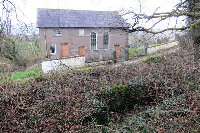
Image: © Alan Richards Taken: 2 Feb 2022
Capel Cwmsarnddu, addoldy'r Bedyddwyr ac yn y blaendir mae'r hen fedyddfa sy bellach wedi'i hesgeuluso. Cwmsarnddu Baptist Chapel with the now neglected baptistery in the foreground.
Images are licensed for reuse under creativecommons.org/licenses/by-sa/2.0
Image Location


Leaflet Map data © OpenStreetMap
Latitude
52.01362
Longitude
-3.834167