Raymond Hall - Heytesbury
Introduction
The photograph on this page of Raymond Hall - Heytesbury by Ronald Searle as part of the Geograph project.
The Geograph project started in 2005 with the aim of publishing, organising and preserving representative images for every square kilometre of Great Britain, Ireland and the Isle of Man.

There are currently over 7.5m images from over 14,400 individuals and you can help contribute to the project by visiting https://www.geograph.org.uk
Raymond Hall - Heytesbury
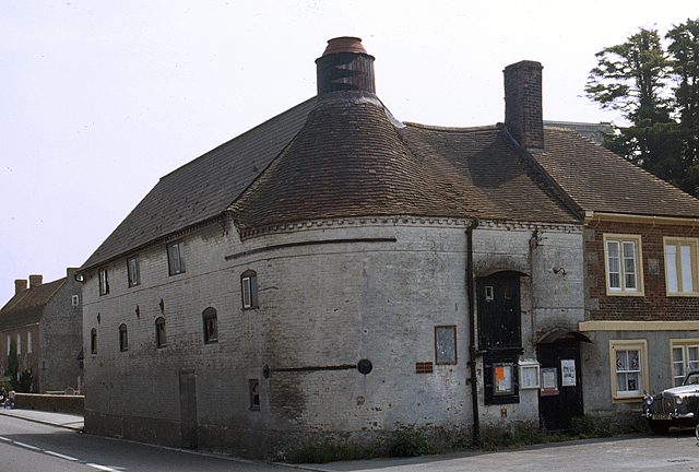
Image: © Ronald Searle Taken: Unknown
A former maltings dating from the late C18, and latterly a disused village hall, although in 1976 when this photo was taken, it was probably still in use as a village hall. The curved end is explained by the fact that it incorporates a circular oast house. Grade II Listed. Compare this image with the modern view thirty years later Image Apart from a modern sprucing up, there has also been some small alterations, probably to facilitate its conversion to a private house.
Images are licensed for reuse under creativecommons.org/licenses/by-sa/2.0
Image Location
Latitude
51.181678
Longitude
-2.111542