Shelters on Ham Green
Introduction
The photograph on this page of Shelters on Ham Green by Neil Owen as part of the Geograph project.
The Geograph project started in 2005 with the aim of publishing, organising and preserving representative images for every square kilometre of Great Britain, Ireland and the Isle of Man.

There are currently over 7.5m images from over 14,400 individuals and you can help contribute to the project by visiting https://www.geograph.org.uk
Shelters on Ham Green
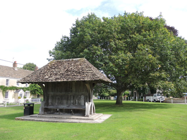
Image: © Neil Owen Taken: 16 Aug 2021
The wooden shelter stands close to the large tree, both offering a modicum of shelter. The tree is a more modern specimen: in the nineteenth century there was a very large elm tree here with a girth of 36 feet and height of 120 feet! But it became diseased and after a terible gale on 19th December, 1884, came down and almost flattened a cottage. The New Inn decided to change its name to Ham Tree thereafter. A new elm tree was planted to replace it but that too became diseased and was felled in 1975. Ham Green was created after the 1867 Enclosure Act, when it was one of four parcels of land allocated to the churchwardens and overseers of Holt. The village stocks were also here in the early 1800s.
Images are licensed for reuse under creativecommons.org/licenses/by-sa/2.0
Image Location
Latitude
51.353747
Longitude
-2.203866