Oare houses [2]
Introduction
The photograph on this page of Oare houses [2] by Michael Dibb as part of the Geograph project.
The Geograph project started in 2005 with the aim of publishing, organising and preserving representative images for every square kilometre of Great Britain, Ireland and the Isle of Man.

There are currently over 7.5m images from over 14,400 individuals and you can help contribute to the project by visiting https://www.geograph.org.uk
Oare houses [2]
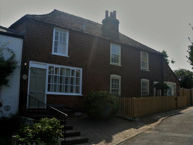
Image: © Michael Dibb Taken: 5 Sep 2021
Numbers 2 and 3 Mount Pleasant were originally one house, now two. A 17th century timber framed building, clad in brick in the 19th century, all under a tile roof. The shop window and the extension on the right are 20th century. Listed, grade II, with details at: https://historicengland.org.uk/listing/the-list/list-entry/1344021 Oare is a low lying village on the bank of Oare Creek, just over one mile northwest of Faversham. To the north are the Oare Marshes, a nature reserve, an important stopping place for migratory birds. Oare was the southern terminus of the Harty Ferry, which ran across the Swale channel between the Isle of Harty and the mainland. Huguenot refugees founded Oare gunpowder works around 1690 using their knowledge of the advanced French gunpowder.
Images are licensed for reuse under creativecommons.org/licenses/by-sa/2.0
Image Location
Latitude
51.329611
Longitude
0.878604