Almeley primary school
Introduction
The photograph on this page of Almeley primary school by Fabian Musto as part of the Geograph project.
The Geograph project started in 2005 with the aim of publishing, organising and preserving representative images for every square kilometre of Great Britain, Ireland and the Isle of Man.

There are currently over 7.5m images from over 14,400 individuals and you can help contribute to the project by visiting https://www.geograph.org.uk
Almeley primary school
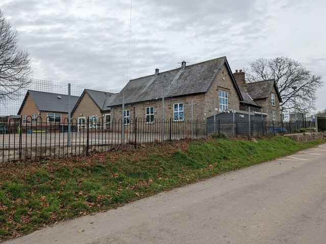
Image: © Fabian Musto Taken: 22 Dec 2021
Here is the primary school at Almeley, housed in a Victorian building that may have been built in the 1860s. This is the rear view of the school, and this view shows a modern extension to the left that dates from 2012. This was taken from a country lane by the primary school.
Images are licensed for reuse under creativecommons.org/licenses/by-sa/2.0
Image Location
Latitude
52.158298
Longitude
-2.972775