Wilton houses [8]
Introduction
The photograph on this page of Wilton houses [8] by Michael Dibb as part of the Geograph project.
The Geograph project started in 2005 with the aim of publishing, organising and preserving representative images for every square kilometre of Great Britain, Ireland and the Isle of Man.

There are currently over 7.5m images from over 14,400 individuals and you can help contribute to the project by visiting https://www.geograph.org.uk
Wilton houses [8]
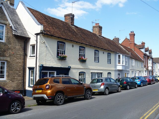
Image: © Michael Dibb Taken: 25 Aug 2021
Odd numbers 67 to 75 North Street are a row of five cottages, with numbers 73 and 75 a different build. Number 67 has a late 19th century shopfront. Constructed of painted brick under a tile roof. Listed, grade II, with details at: https://historicengland.org.uk/listing/the-list/list-entry/1023725 A former county town, Wilton is situated some 2¾ miles west of Salisbury on the confluence of the River Nadder and the River Wylye. The town grew around Wilton Abbey, founded in the 8th century, and was the administrative capital of Wiltshire until the 11th century. The town declined in importance after Salisbury Cathedral was built. The town is renowned for carpet manufacture, which began in 1741 when two French weavers were brought in and a carpet factory continued to operate until 1995. The country estate of Wilton House is an integral part of the town.
Images are licensed for reuse under creativecommons.org/licenses/by-sa/2.0
Image Location
Latitude
51.081955
Longitude
-1.861544