Pillbox by footpath 407 Salfords & Sidlow
Introduction
The photograph on this page of Pillbox by footpath 407 Salfords & Sidlow by Robin Webster as part of the Geograph project.
The Geograph project started in 2005 with the aim of publishing, organising and preserving representative images for every square kilometre of Great Britain, Ireland and the Isle of Man.

There are currently over 7.5m images from over 14,400 individuals and you can help contribute to the project by visiting https://www.geograph.org.uk
Pillbox by footpath 407 Salfords & Sidlow
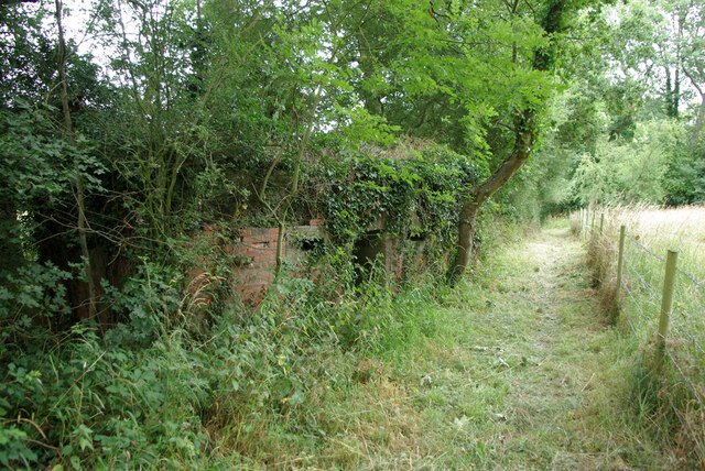
Image: © Robin Webster Taken: 18 Jul 2010
More significantly, behind to the left is the River Mole, which was a defence line with many pillboxes along it. Defence of Britain reference S0002463.
Images are licensed for reuse under creativecommons.org/licenses/by-sa/2.0
Image Location
Latitude
51.191949
Longitude
-0.180096