Approach to the Bobbin Mill Tunnel
Introduction
The photograph on this page of Approach to the Bobbin Mill Tunnel by Oliver Dixon as part of the Geograph project.
The Geograph project started in 2005 with the aim of publishing, organising and preserving representative images for every square kilometre of Great Britain, Ireland and the Isle of Man.

There are currently over 7.5m images from over 14,400 individuals and you can help contribute to the project by visiting https://www.geograph.org.uk
Approach to the Bobbin Mill Tunnel
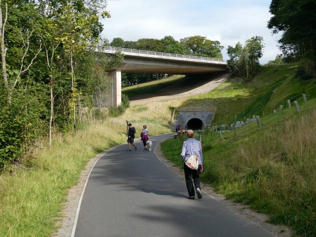
Image: © Oliver Dixon Taken: 6 Sep 2021
The Bobbin Mill Tunnel was originally one of the two tunnels on the Cockermouth, Keswick and Penrith railway line. The line was closed in 1972. The Greta viaduct in the background carries the A66 over the River Greta and was completed in 1977. It was voted "Best Concrete Engineering Structure of the Century" by "Concrete" magazine. Subsequently a path was constructed along the line of the old railway line from Keswick as far as Threlkeld. It was thought that the integrity of the tunnel might have been compromised by the viaduct construction and it was sealed off. An alternative route for the path was installed on a wooden walkway round the outside of the spur. The walkway was destroyed by Storm Desmond in 2015. When the path was reconstructed, it was determined that the tunnel was safe after all and was incorporated into the path. The path forms part of the C2C cycle route (National Cycle Network route 71) and is very popular with walkers and cyclists.
Images are licensed for reuse under creativecommons.org/licenses/by-sa/2.0
Image Location
Latitude
54.60522
Longitude
-3.114439