Two viaducts
Introduction
The photograph on this page of Two viaducts by philandju as part of the Geograph project.
The Geograph project started in 2005 with the aim of publishing, organising and preserving representative images for every square kilometre of Great Britain, Ireland and the Isle of Man.

There are currently over 7.5m images from over 14,400 individuals and you can help contribute to the project by visiting https://www.geograph.org.uk
Two viaducts
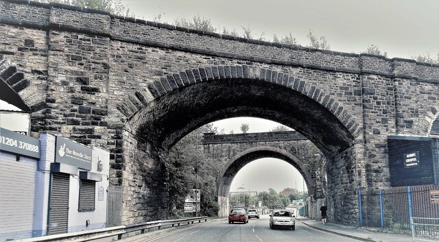
Image: © philandju Taken: 26 Jul 2021
The viaduct further from the camera carries the Bolton to Blackburn railway line over Folds Road. The nearer viaduct used to carry a branch line to Astley Bridge. That line was opened in 1877 but closed to passenger traffic as soon as 1879 because of very low usage. The tram from Astley Bridge to Bolton via Blackburn Road was cheaper and more convenient. The line continued to carry freight, mainly coal, until the late 1950s, but closed completely in 1963. All that remains today is the viaduct shown here.
Images are licensed for reuse under creativecommons.org/licenses/by-sa/2.0
Image Location
Latitude
53.5854
Longitude
-2.419291