West Barnes: West Barnes Lane and Motspur Park
Introduction
The photograph on this page of West Barnes: West Barnes Lane and Motspur Park by Nigel Cox as part of the Geograph project.
The Geograph project started in 2005 with the aim of publishing, organising and preserving representative images for every square kilometre of Great Britain, Ireland and the Isle of Man.

There are currently over 7.5m images from over 14,400 individuals and you can help contribute to the project by visiting https://www.geograph.org.uk
West Barnes: West Barnes Lane and Motspur Park
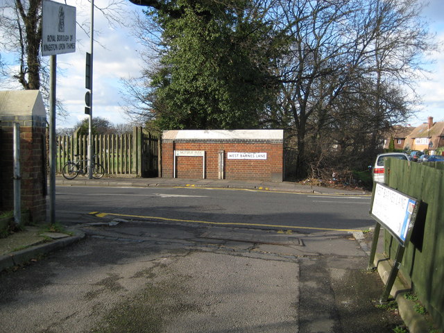
Image: © Nigel Cox Taken: 30 Jan 2008
The grubby white post against the bridge parapet is a boundary marker. It shows the boundary between the former Boroughs of Malden and Coombe to the left and Merton and Morden to the right. During the reorganization of local government in the 1960s, the former became part of the London Borough of Kingston upon Thames, and the latter became part of the London Borough of Merton. The current boundary between these Boroughs still follows the original line through the marker. The sign on the post on the left shows that you are entering the Royal Borough of Kingston upon Thames. The road changes its name from Motspur Park to West Barnes Lane either side of the boundary post. The bridge carries the road over Beverley Brook.
Images are licensed for reuse under creativecommons.org/licenses/by-sa/2.0
Image Location
Latitude
51.393345
Longitude
-0.242117