Albany Road, Earlsdon
Introduction
The photograph on this page of Albany Road, Earlsdon by E Gammie as part of the Geograph project.
The Geograph project started in 2005 with the aim of publishing, organising and preserving representative images for every square kilometre of Great Britain, Ireland and the Isle of Man.

There are currently over 7.5m images from over 14,400 individuals and you can help contribute to the project by visiting https://www.geograph.org.uk
Albany Road, Earlsdon
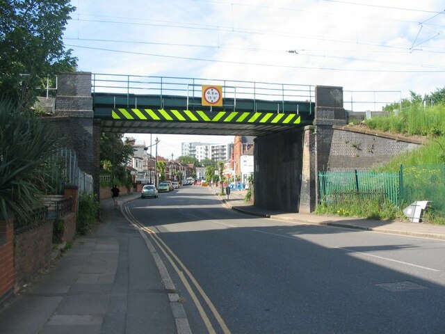
Image: © E Gammie Taken: 4 Jun 2021
One of two railway bridges crossing Albany Road. This one carries the Coventry to Birmingham line. Some remedial work has been done on the bridge and a tree has been removed since Image] was taken in 2016. Albany Road was constructed between the city and Earlsdon in 1898 after several years of negotiations with landowners along the proposed route which followed the approximate course of a pre-existing footpath known as Earlsdon Jetty. House building along the road was sporadic, with the earliest c. 1900 at the city end followed by development in small increments until a block of 20 houses in the 1920s at the Earlsdon end, followed by the usual piecemeal modifications over later years. A tram route ran along the road to Earlsdon Street from the early 1900s to 1937.
Images are licensed for reuse under creativecommons.org/licenses/by-sa/2.0
Image Location
Latitude
52.401676
Longitude
-1.526972